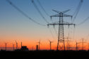
National Grid has officially launched its record-breaking Viking Link interconnector cable between the UK and Denmark, in what it says is the "next step towards a North Sea super-grid".
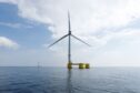
Equinor (OSE:EQNR) has received development consents for its plans to extend the operational Sheringham Shoal and Dudgeon offshore wind farms off the North Norfolk coast.
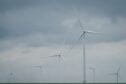
Alexander Quayle, project director, Flotation Energy and Chris Hill, UK managing director, Vårgrønn spoke about the current opportunity for UK offshore wind jobs.
Fabrication giant Harland & Wolff (H&W) expects to create at least 200 new jobs at Arnish, on Lewis, and 400 in Fife through a £270 million investment in its the Scottish shipyards.
BP has cut more than a tenth of its workforce from its electric vehicle charging business, BP Pulse, and pulled out of several markets, it has been reported.
Australian Prime Minister Anthony Albanese plans an Inflation Reduction Act-style program to stimulate green manufacturing industries and drive his nation’s economy beyond its traditional minerals extraction base while bolstering economic security.
The European Union ramped up pressure on Chinese clean-tech investments potentially squeezing out its local suppliers amid EU efforts to transform the bloc into a green economy.
As a leader in high-efficiency electric motors, ABB IEC Low Voltage (LV) Motors offers reliable energy-efficient motors for various industries including metals, chemicals, cement and mining, food and beverage.
A former highlands RAF and Royal Navy base is set to be repurposed for renewables under the Inverness and Cromarty Firth green freeport as tax incentives roll in.
More than two thirds of university energy degrees worldwide remain focused on the fossil fuel industry rather than renewables, according to a new study.